Trails
The Lead trails will take you down Lead’s beautiful, mountain-side Main Street where you can see relics from Lead’s gold mining past and beautiful modern art, side by side.
Explore history and lore from the Homestake Gold Mine, which was the largest and deepest gold mine in North America. Then, take your hike into the woods and see nature’s bounty. You might even end up in Historic Deadwood.
gold run interpretive Park
0.34 miles | 90’ elevation gain/loss | out and back | easy
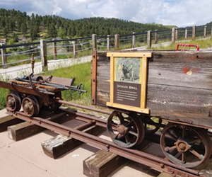
Located on Enos Street, the Homestake Gold Run Park Trail is constructed on the site of the Homestake Mining Company’s gold mills. This interpretive trail winds through old concrete walls and foundations to two upper display decks that provide a unique view of Lead. Along the trail are numerous items, equipment, tools and curiosities that were used in the Homestake Mine and Mill. Interpretive signs along the trail discuss the items and the site. The trail has a public restroom and the concrete path is ADA compliant.


urban art walk
1 mile | 113’ elevation gain/loss | loop | easy
The idea for the Lead Urban Art Walking Tour was born in 2014. Its mission is to help beautify Lead, promote civic pride, support local artists, and attract tourism. Click the link to see the map, urban art, and to learn more about the funding for the project.

Lead Historic Main Street Trail
1 mile | 190’ elevation gain/loss | out and back | easy
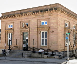
Stroll along Lead’s Historic Main Street to visit numerous sites that were important to the development of the community. Follow a self-guided tour through Lead. You can pick up a brochure at any of the public locations throughout town or click the link to download the digital brochure.

Mickelson Trail Lead Railroad Spur
0.9 miles | 77’ elevation gain/loss | out and back | easy
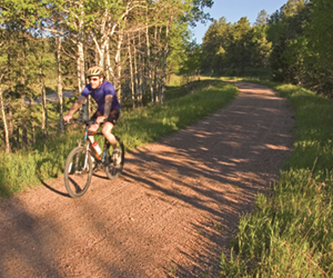
The Mickelson Trail is 109 miles long, running from Deadwood to Edgemont. and contains more than 100 converted railroad bridges and 4 rock tunnels. This spur connects Lead to the Mickelson Trail. (Photo credit: Black Hills and Badlands)

homestake trail
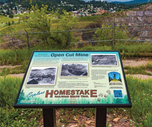
1.3 miles | 160’ elevation gain/loss | out and back | moderate
This trail was created and is maintained by the Northern Hills Recreation Association and Trail Committee members. The trail winds from Lead to Deadwood along an old Homestake Railroad grade providing the user with fantastic views. Total mileage out and back is 5.7 miles. (Photo credit: Travel SD)

Lead overlook trail
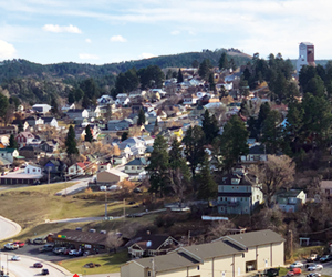
0.5 miles | 27’ elevation gain/loss | out and back | easy
This flat walking trail begins at the west end of Miners Avenue and takes the traveler along Miners Avenue to the east through an older, established neighborhood in Lead. The trail ends at the west side of the Homestake Open Cut, giving the viewer a unique look at south and east Lead. This view provides an overlook of the Sanford Lab Homestake Visitor Center, both shaft headframes serving the underground laboratory and the homes and businesses in the area.


CONTACT
Lead Historic Preservation
Lead City Hall
801 W Main St
Lead, SD 57754
(605) 581-1401
