Past & Present Photos
Discover all the changes Lead has undergone. Here are photographs of ten geographic sites in Lead, both historicallly significant and best suitable for re-photography.
Southside of Main Street between Siever and Stone Streets View from Miners Avenue
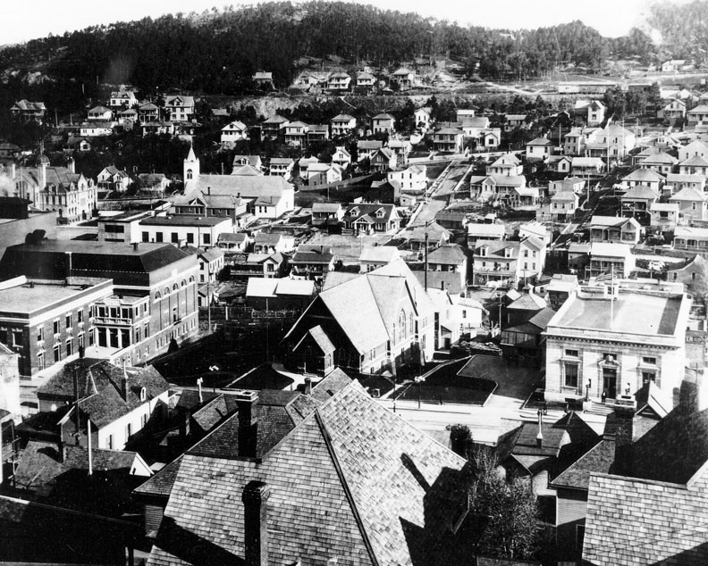
Past c. 1910s
(L-R) Homestake Opera House (1914), Christ Church, Episcopal (1896), U.S. Post Office (1912)
Background: Central School Campus (1896/1915), St. Patrick’s Catholic Church (1902)
Credit: Homestake Adams Research and Cultural Center, Deadwood, SD
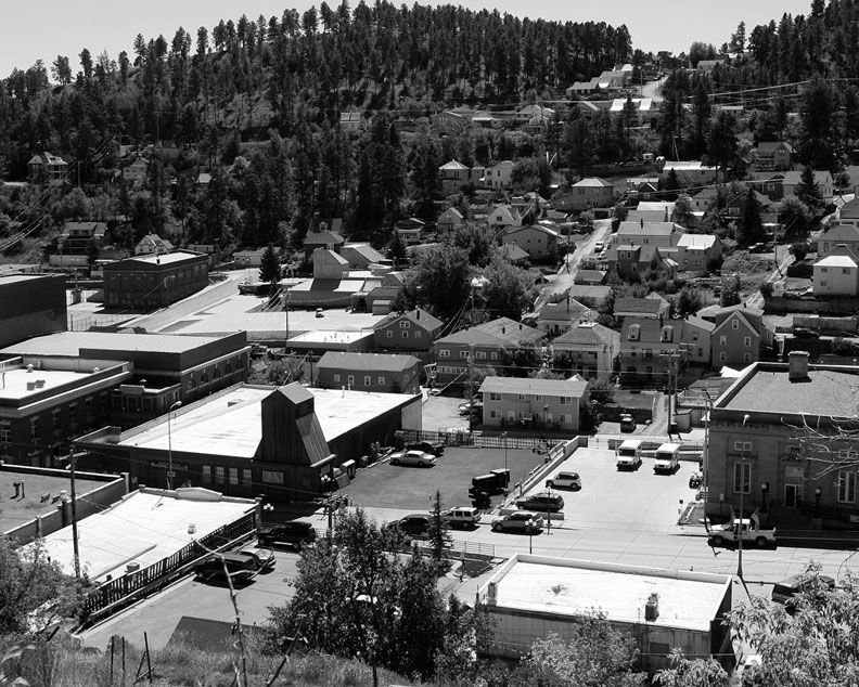
Present c. 2010
(L-R) Homestake Opera House (1914), Black Hills Mining Museum (1987), U.S. Post Office (1912)
Background: Central School Campus (2002), St. Patrick’s Catholic Church (1982)
Credit: Richard Carlson, Lead, SD
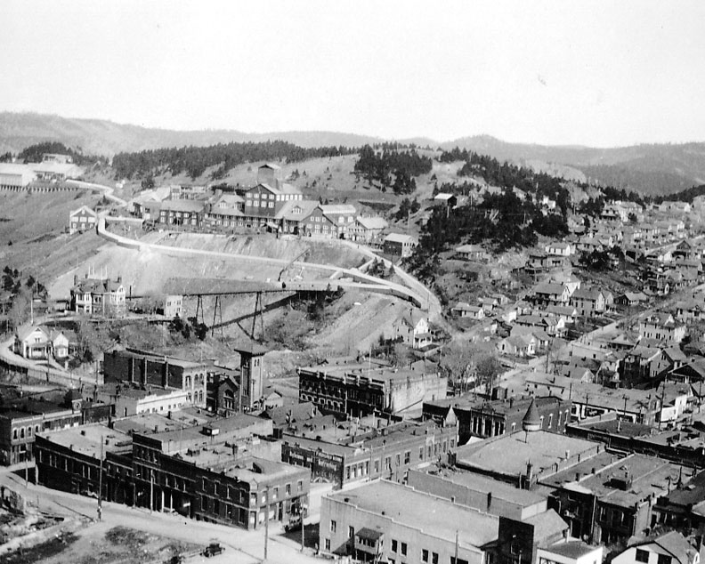
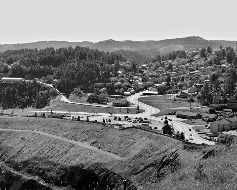
Homestake Open Cut Area • View from Ellison Hill looking northwest
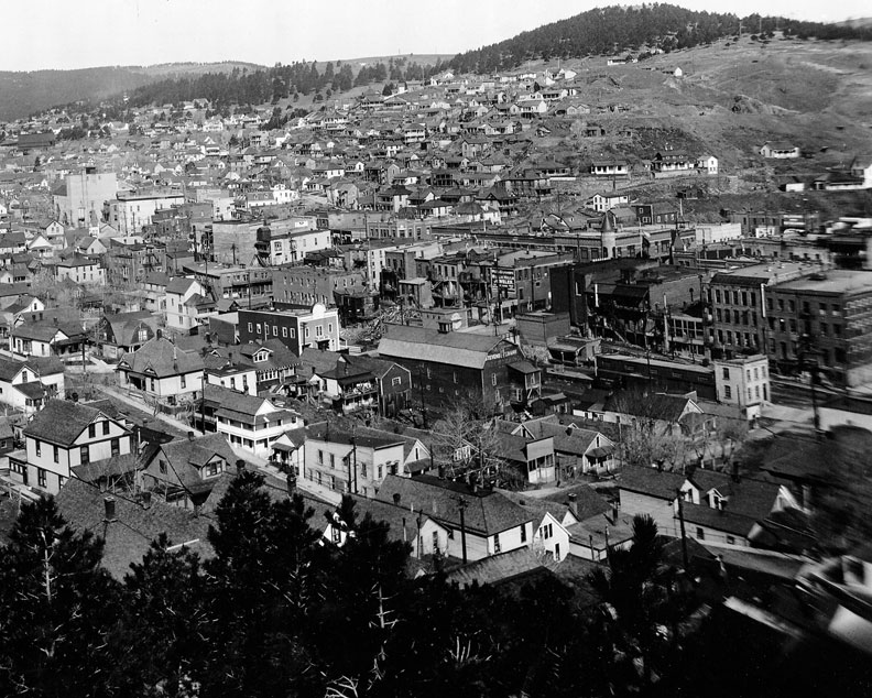
Past c. 1918
Upper right: Open Cut subsidence, caused by extensive mining operations, both surface and underground
Center: Lead business area prior to removal for subsidence issues
Far left: Homestake Opera House (with square chimney)
Credit: Homestake Adams Research and Cultural Center, Deadwood, SD
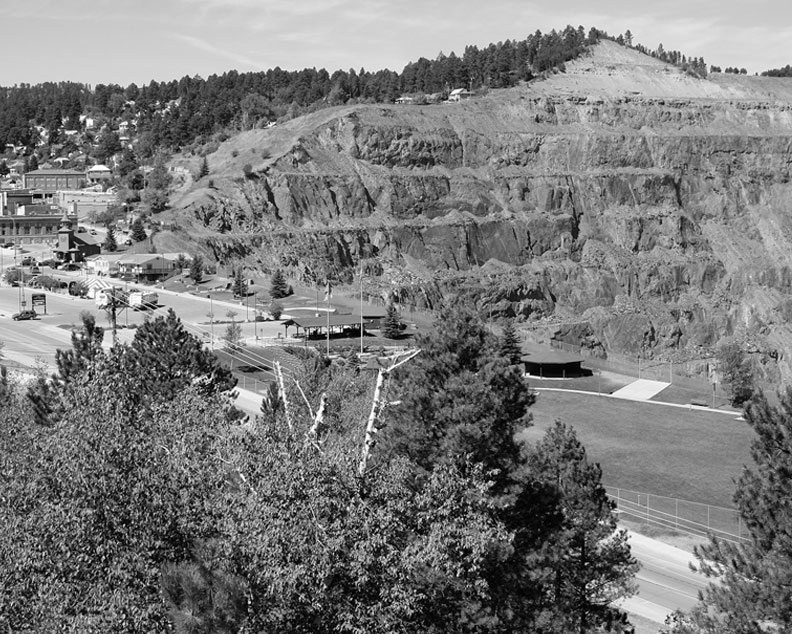
Present c. 2010
Right: Open Cut Mine
(L-R) Opera House, Main Street, Visitor Center, Manuel Brothers Park
Left Center: Former Finnish First Lutheran Church
Credit: Richard Carlson, Lead, SD
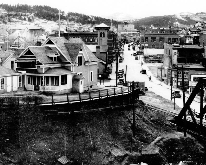
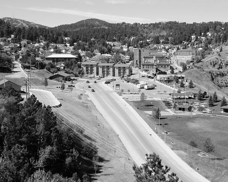
Homestake General Manager’s Residence • View from Forest Avenue
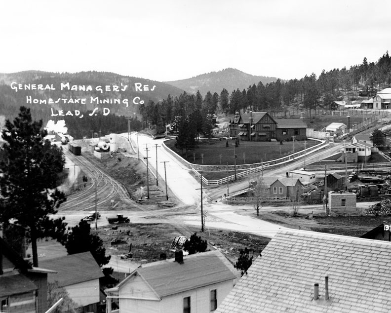
Past c. 1930s
Center: The Homestake Manager’s Residence (1932-33) on Fairview Avenue
Right: Bender’s Park—Homestake’s carpenter shop, lumber shed and loading dock area
Credit: Homestake Adams Research and Cultural Center, Deadwood, SD
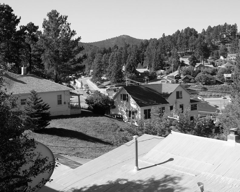
Present c. 2010
Center: Homestake Manager’s Residence is hidden in the spruce trees (privately owned)
The Twin City Mall occupies the area that was Bender’s Park
US Highway 85/14A is visible to left (on old Black Hills & Ft. Pierre Railroad grade)
Credit: Richard Carlson, Lead, SD
Lead Main Street • View looking up Lead Main Street
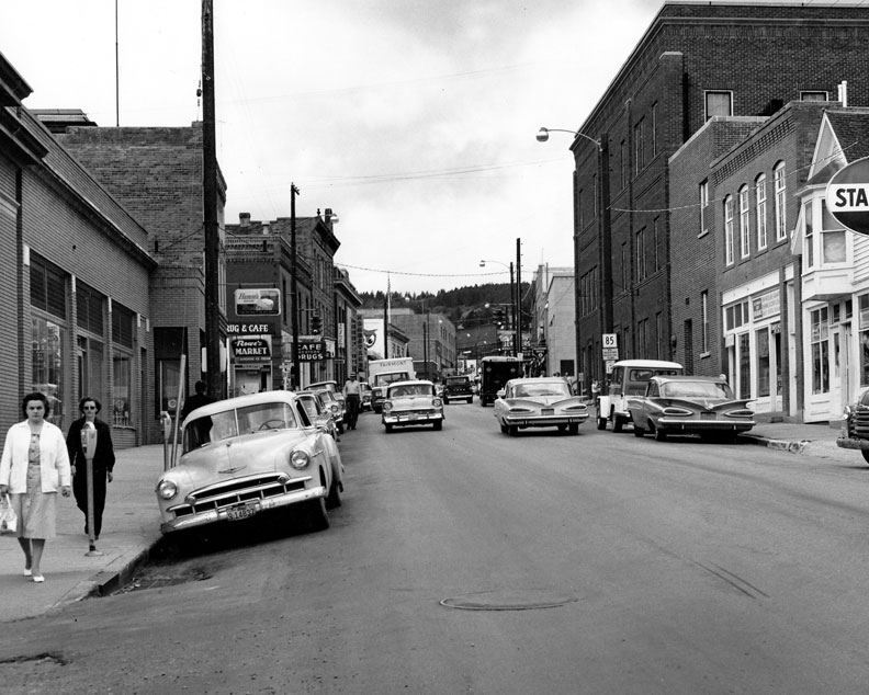
Past c. 1950s
Left side of street: (Seeling Lang Block) First National Bank, Homestake Public Relations/Employment Office, Rowe’s Market, Newell’s Drug Store, J&E Shop, Homestake Opera House and Red Owl Grocery Store
Right side of street: (Maleta Block) Barber Shop, Edlund’s Shoe Repair, Nelson/Scott Insurance Agency, Homestake Hospital and Miner’s & Merchant’s Bank
Credit: Homestake Adams Research and Cultural Center, Deadwood, SD
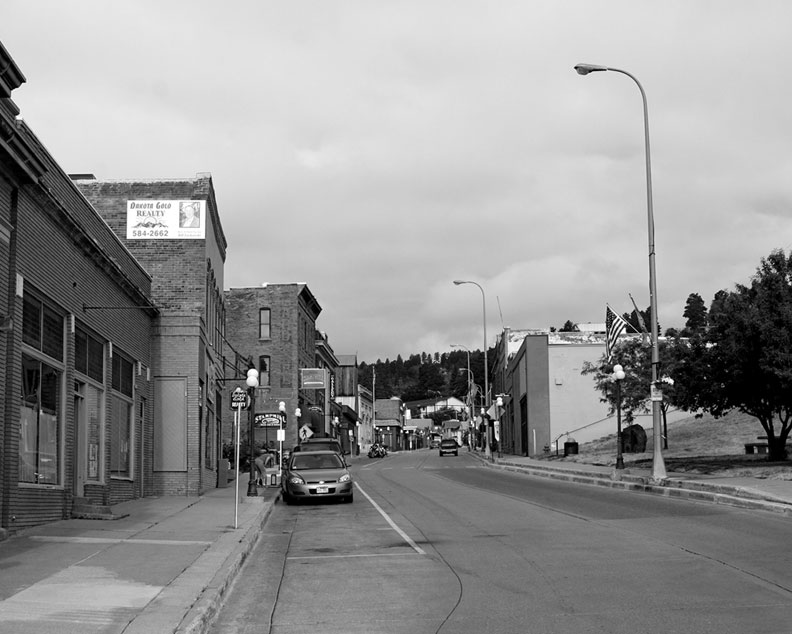
Present c. 2010
Left side of street: (Seeling Lang Block) Wells Fargo Bank, Johns & Kosel Law Office, Movie Madness,
Real Estate Office, Stamp Mill, Homestake Opera House and Black Hills Mining Museum
Right side of street: (Maleta Block) Prospect Park, Center of Hope
Credit: Richard Carlson, Lead, SD
Lead Main Street • View from Lead City Shops on Ellison Hill
Past c. 1930
(L-R) Palethrope House built in 1910 for Homestake Mining Company (HMC) Manager Grier’s in-laws, Northwestern Train Depot (tower), Opera House, First National Bank (across the street)
Credit: Homestake Adams Research and Cultural Center, Deadwood, SD
Present c. 2010
(L-R) Central School Campus , Timberland Apartments, Opera House, Wells Fargo Bank,
Homestake Apartment House, Visitor Center/Manuel Brothers Park
Credit: Richard Carlson, Lead, SD
Mill Street Area • View from Sunnyhill Road
Past c. 1920s
(L-R) Ellison Shaft Complex 1896-1930; Sawyer, Mill and Bleeker Streets
Foreground: Center of Lead, before subsidence
Credit: Homestake Adams Research and Cultural Center, Deadwood, SD
Present c. 2010
(L-R) Lead City Shop, Ellison Hill, Dental Office, Sawyer, Mill and Bleeker Streets
Foreground: Open Cut and Highway 85
Credit: Richard Carlson, Lead, SD
Washington Street Area • View from Ellison Hill
Past c. 1924
(L-R) Amicus Mill, HMC Electric Substation, B&M #2 Shaft (on hillside), Steam Auxiliary Station (short stacks), Central Boiler Plant (tall stacks), Electric & Steam Lines & Coal Conveyor (foreground)
Credit: Homestake Adams Research and Cultural Center, Deadwood, SD
Present c. 2010
B&M #2 Headframe (in the trees), Electric Substation, Dog Park, Twin City Transit Mix, Washington Street
Credit: Richard Carlson, Lead, SD
Lower Gold Run Creek Area • View from HMC Mill Property
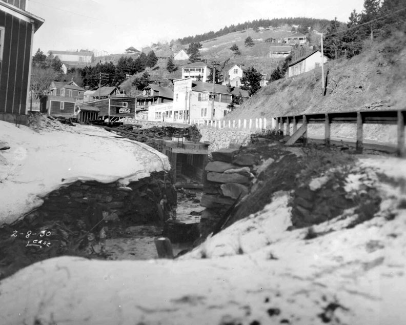
Past 2/8/1930
(L-R) HMC Mill Building, Gold Run Creek, Richardson Bottling Plant and Ice Cream Factory and Store
Credit: Homestake Mining Company, Lead, SD
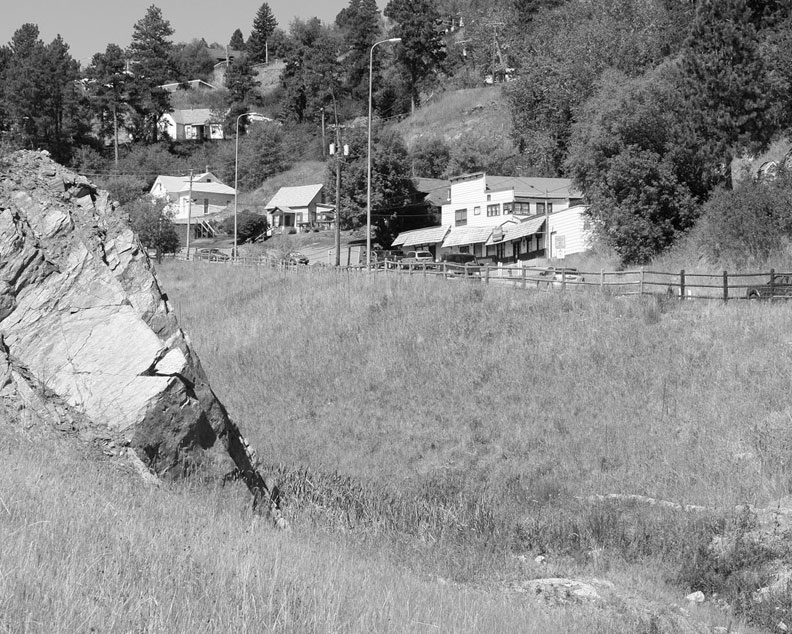
Present c. 2010
King’s Grocery
Credit: Richard Carlson, Lead, SD
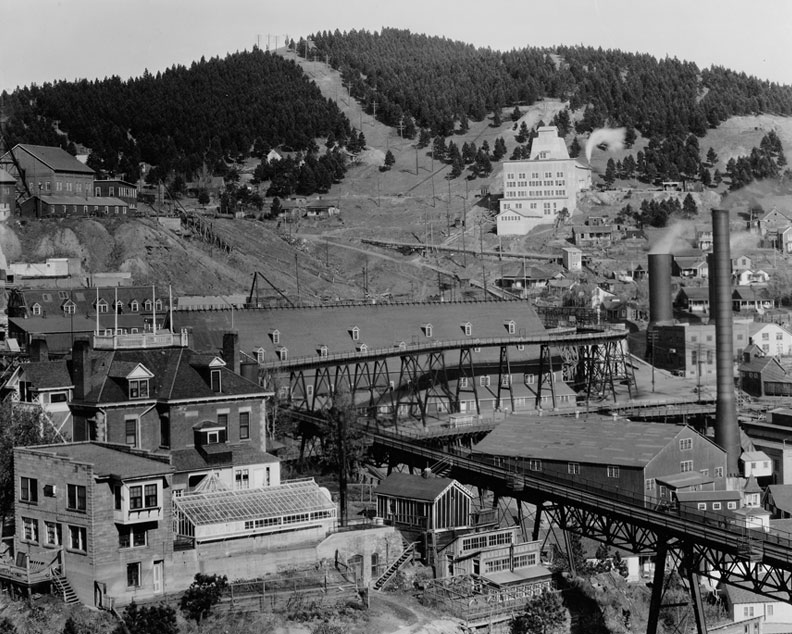
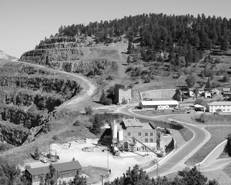
Homestake Mill Area • View from Washington Street
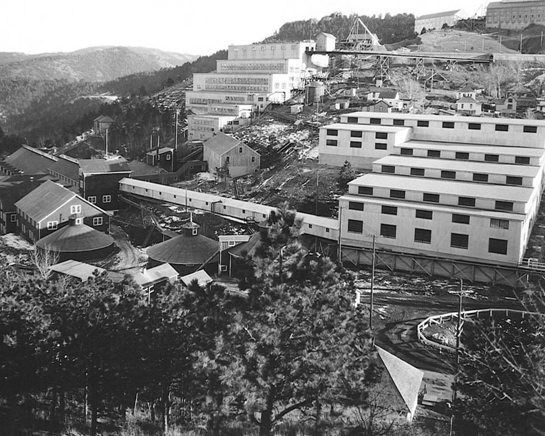
Past C. 1930s
(L-R) Cyanide Plant #1 (1901), Assay Department, East Sand Plant, South Mill (1920),
Ore Tramway into South Mill, Pattern Shop and Foundry (on top of hill), Cyanide #3
Credit: Homestake Mining Company, Lead, SD
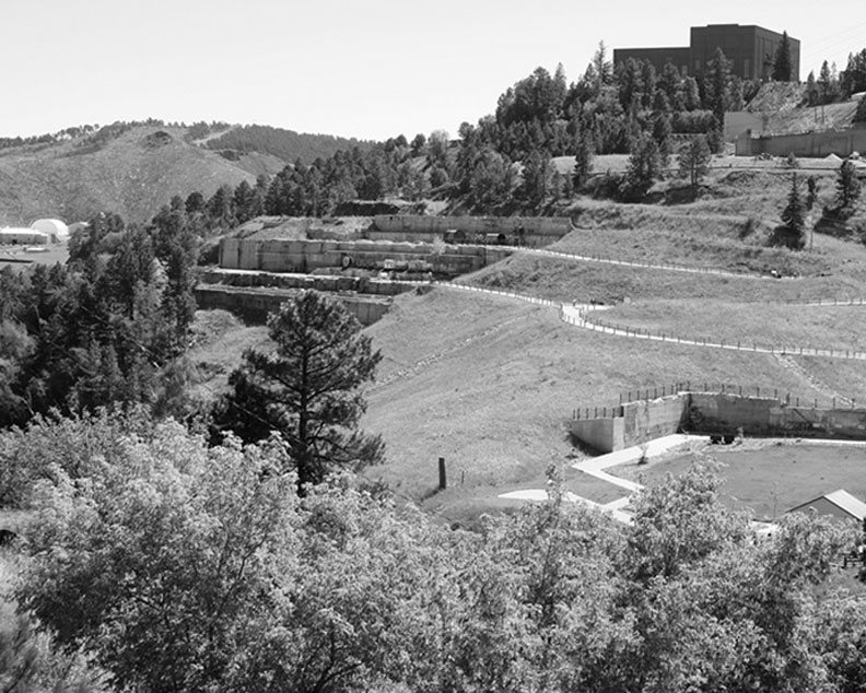
Present c. 2010
Gold Run Park, Yates Engine/Hoist Room, Yates Headframe, Homestake Foundry
Credit: Richard Carlson, Lead, SD
Homestake Ross Shaft Complex • View from above Kirk Road
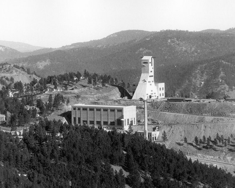
Past 2/1/1934
Ross Engine/Hoist Room, Ross Headframe
Credit: Homestake Mining Company, Lead, SD
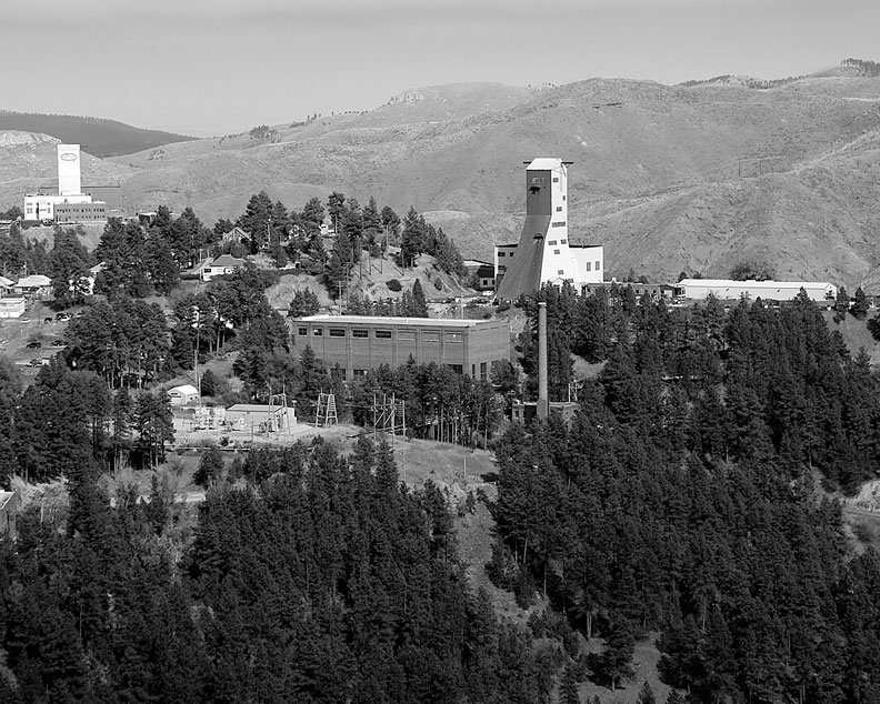
Present c. 2010
Yates Headframe (to the left), Ross Substation, Ross Hoist/Engine Room, Ross Headframe,
Homestake Surface Repair Shops
Credit: Richard Carlson, Lead, SD

CONTACT
Lead Historic Preservation
Lead City Hall
801 W Main St
Lead, SD 57754
(605) 581-1401